Google Maps gets major visual overhaul

Fifteen years after the launch of Google Maps, Google has announced a fundamental revision of its map service. First and foremost, a more colorful visualization of the different terrains should make the map material better.
As Google states in a blog entry, after many technical improvements in recent years, they now want to improve the visual representation of their maps. This should make it easier to understand what an area looks like – regardless of whether you're just visiting it virtually or planning a real trip.
Apple had already begun to fundamentally revise the map material at the end of 2018, and now Google has also started to do something similar. Google's goal is to allow users to quickly and easily recognize and distinguish the different terrains of an area. With one glance, one should be able to see whether a place one is lush with green plants or whether a mountain top is snowed in.
One of Google's examples shows the old and new version of Iceland. While the old map mostly shows a white landscape with some green patches, the updated maps allow a more realistic view of the island.
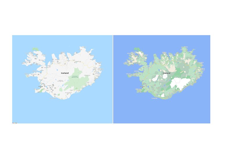
Google uses high-resolution satellite images as the basis for the new maps. Using this data, a computer system recognizes the characteristics of a landscape. The system selects dry, icy, forested, and mountainous regions, which are then assigned different color tones. The result is, for example, that a densely overgrown forest is shown in a strong green, while a few bushes are shown in light green.
Google Maps: Improved details in cities
While the above examples help to get a quick overview of a landscape, Google also wants to make navigation in the urban world easier. To this end, cities and their road networks, for example, are going to be much more detailed.
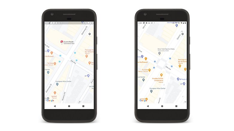
The new maps should, for example, show where sidewalks, crosswalks or pedestrian islands are located. Such information should make it much easier for wheelchair users or parents with strollers to participate in everyday traffic. However, these details will initially be available in a few selected major cities such as London, New York, and San Francisco.
The new color scheme is expected to be available in the first regions later this week. Overall, Google expects the new maps to be visible in all 220 countries and territories supported by Google Maps. This will involve more than 100 million square kilometers.
Source: Google


-
Admin
Aug 20, 2020 Link to commentMap changes already on in Hanoi,Vietnam